Our first public meeting for Eastern Parkway will be held on July 11, 2019 at Audubon Traditional Elementary School in their main gym. It will be held from 5:00-7:00pm.
Gresham Smith is dedicated to collecting as much of your input and applying it to our projects during these early phases of the study.
Interactive Map
We are collecting input on an interactive map that lets you share your issues and big ideas for Eastern. Please click the button on the right to launch the WikiMap and start sharing!
The following exhibits will be on display during our July 11, 2019 public meeting. We will have subject matter experts at each of the stations to help create a platform for knowledge sharing as well as gathering meaningful input from each of you.
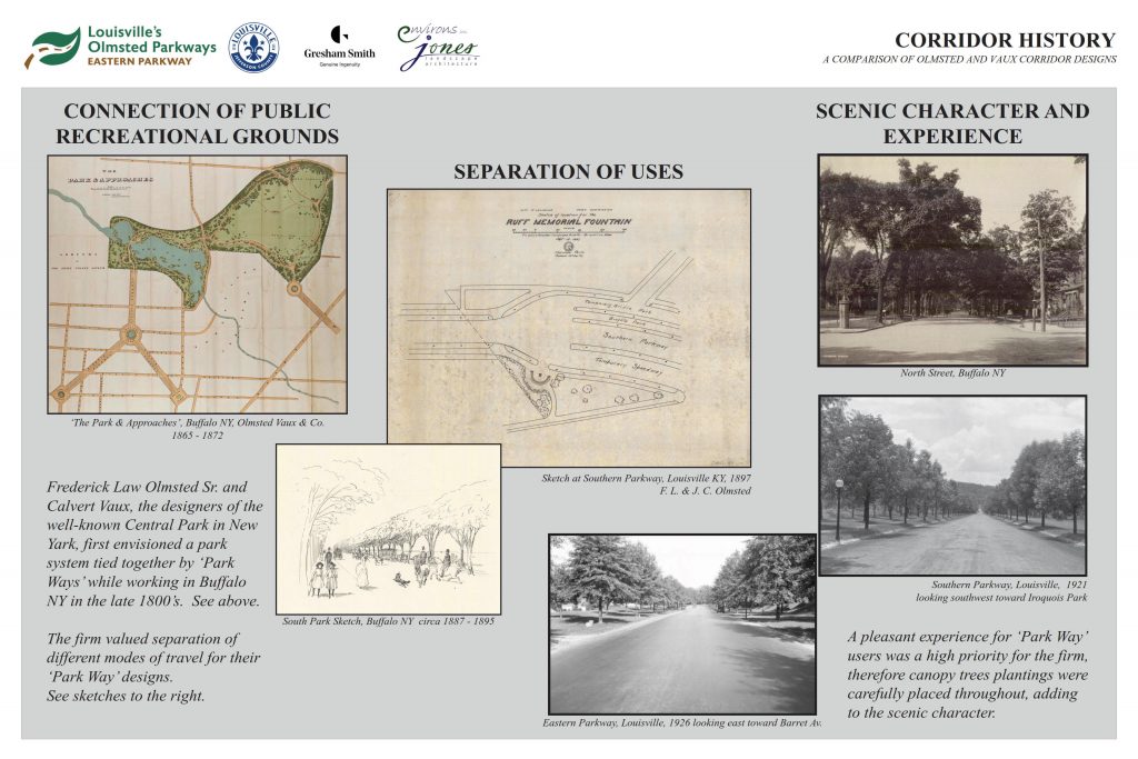
Before we start to plan the future of Eastern Parkway, it is critical to understand the history of the corridor. A big part of that is revisiting how the original design created connections with distinct character as well as how it handled different modes of transportation.
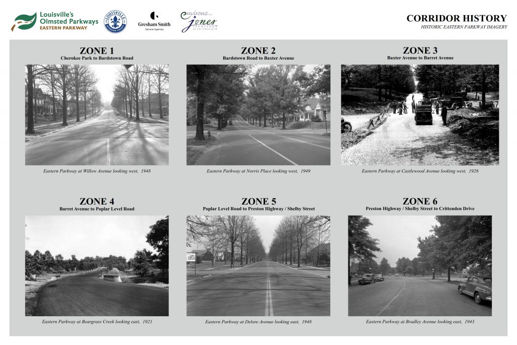
Above, you will find historic pictures that correspond to each of the zones we are currently analyzing.
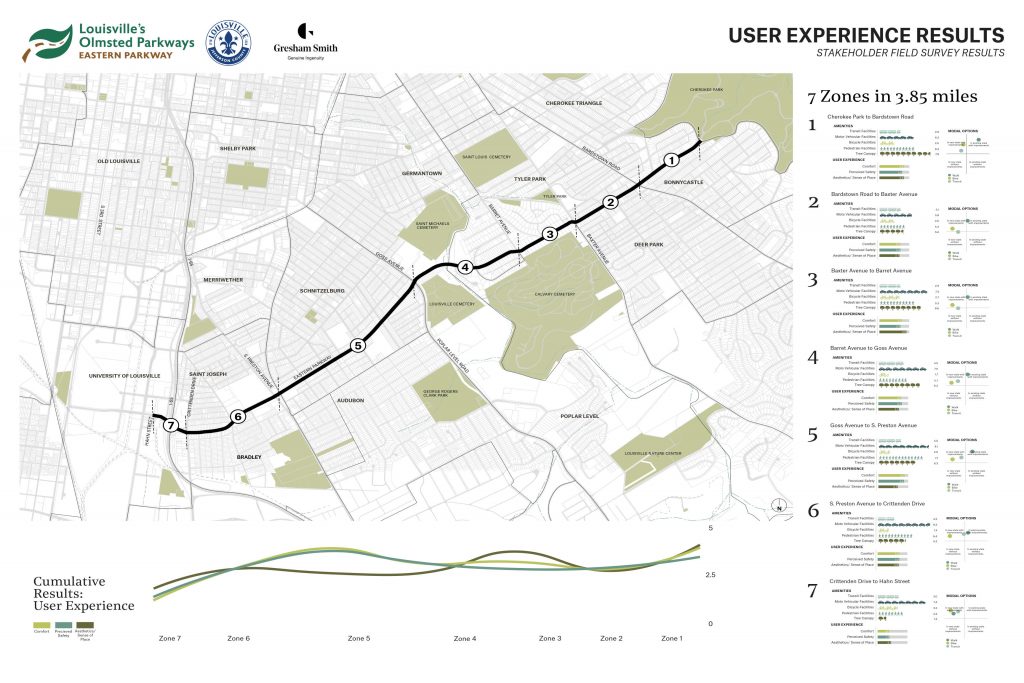
These are the results from our initial user experience field survey that was comprised of project owners and stakeholders along the corridor. We asked each participant to give their thoughts on specific things they liked and disliked along Eastern Parkway. We will be asking the same questions of you during our public meeting.
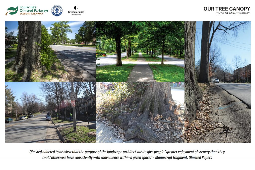
Trees are one of the most valuable resources that exist along our parkways in Louisville. Our design team is fully committed to minimizing impacts to the existing tree canopy, while taking advantage of the opportunities to identify trees in poor condition and include a replacement plan as part of this process. We are undergoing a full tree survey along the corridor to ensure the health of current trees.
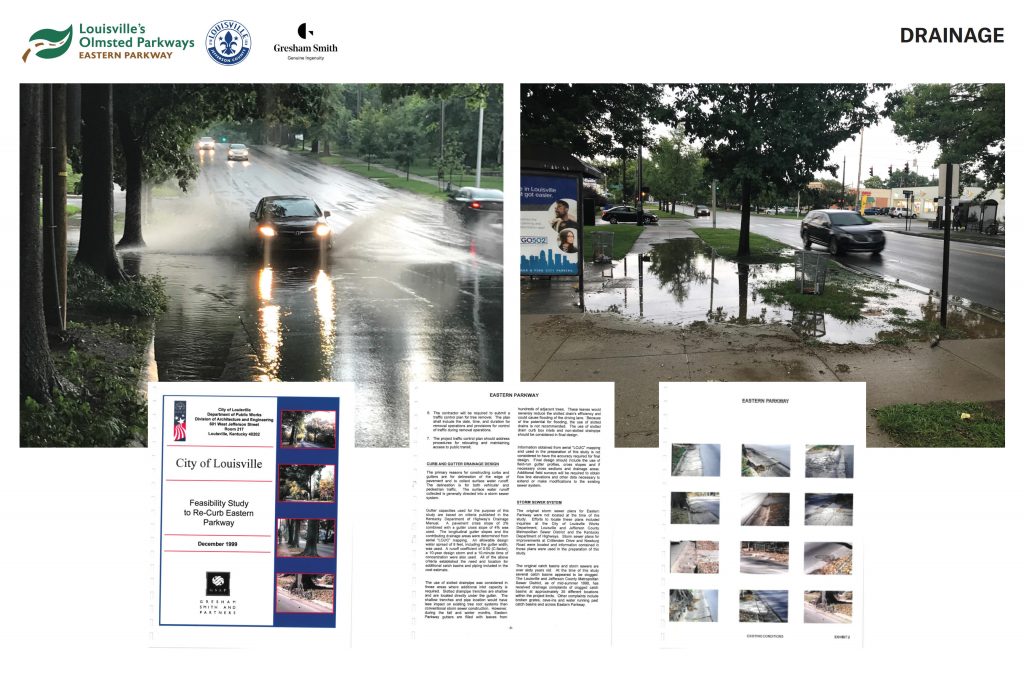
The drainage system on Eastern is aging and continues to be problematic. Our team plans to build on the earlier 1999 study to effectively combat the system from deteriorating even more, and that supports minimizing impacts to adjacent property while maintaining traffic.
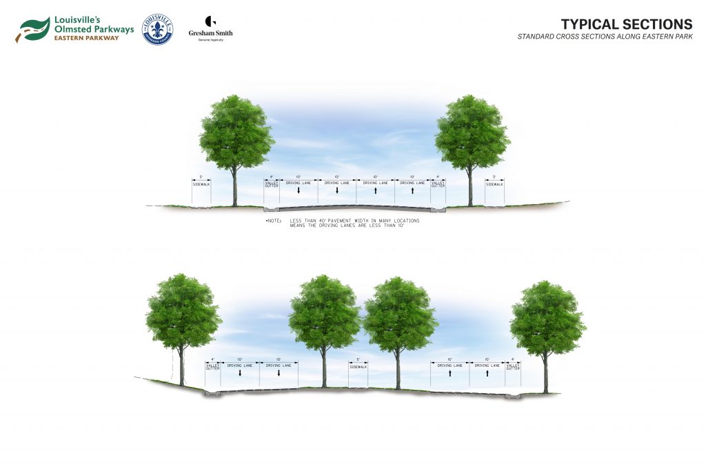
These sections represent the roadway widths that are typically present along Eastern Parkway. It is important to make sure that we understand the constraints that the existing conditions present so when we discuss how we can make the roadway safer for all users, we know how much width we have to work with.
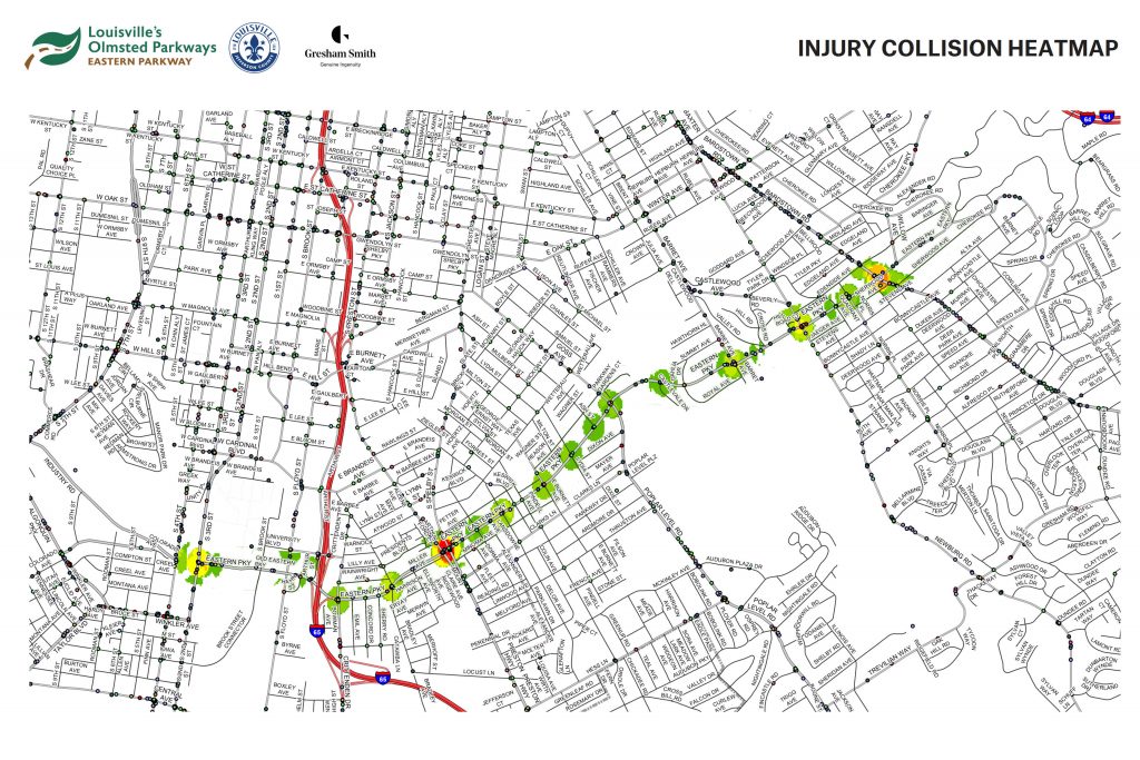
We have mapped the injury collisions along Eastern and have generated a heatmap of problematic intersections.
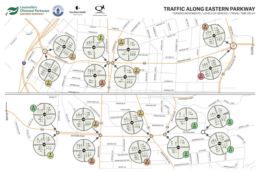
This exhibit shows traffic data which is represented in vehicle counts (the number of cars making specific movements at each of the major intersections), levels of service (a measurement of the amount of other traffic you experience), and travel time delay (the amount of time you are typically waiting at intersections). As we begin to make sure that everyone can access and move along the parkway safely, we want to make sure that we are not doing anything to break access for other users. Part of this balancing takes into consideration signal timing and optimization to help alleviate some of these issues.
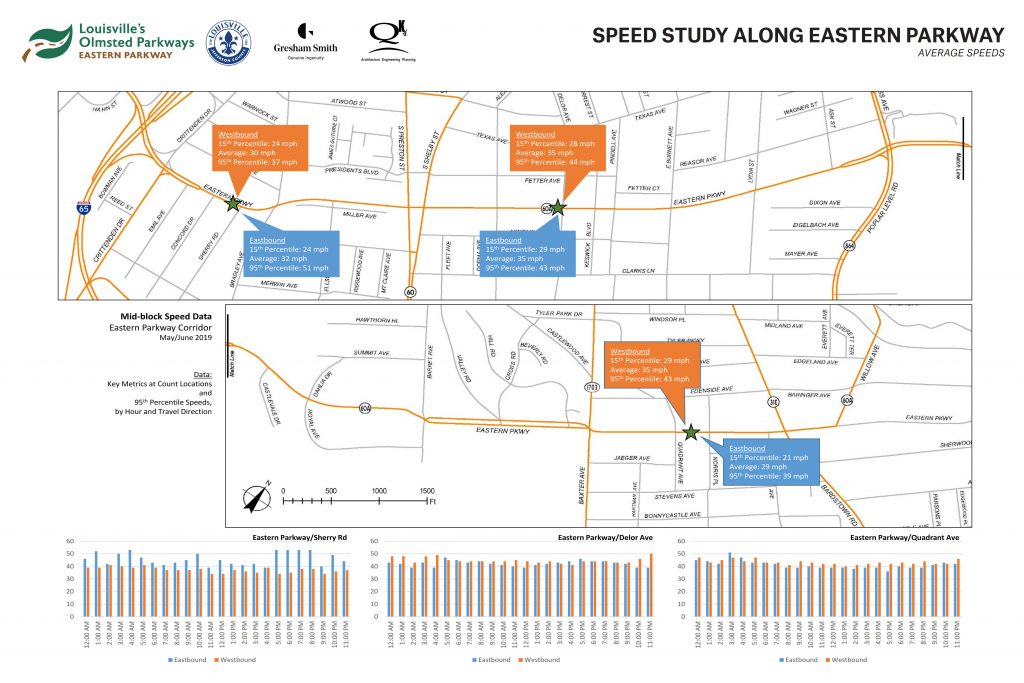
One of the major barriers to walking, biking or taking transit is the overall safety of a corridor. A big factor is operating speed of motor vehicles. This exhibit shows measured speeds along the corridor and will help our team target specific areas of concern.
Where we are...
As you can see below, it is very early in the planning process. We are almost complete with the existing data collection, which is sourced from GIS, online databases as well as field surveys of what exists currently along the corridor.
There is plenty of time to share your ideas and concerns to help shape this planning project.
Data Collection
Geometry, Traffic, Collision, Tree Survey, User Experience75%
Our third and final public meeting for Eastern Parkway was held on Tuesday, January 28, 2020 at Audubon Traditional Elementary School in their main gym. It will be held from 6:00-8:00pm. Date: January 28th, 2020, Tuesday Time: Read more…
Our second public meeting for Eastern Parkway will be held on September 24, 2019 at Audubon Traditional Elementary School in their main gym. It will be held from 6:00-8:00pm. Date: September 24, 2019 Time: 6:00-8:00pm Read more…
Please use the following link to leave comments on our interactive wikimap. The Eastern Parkway map will stay active throughout the public engagement effort.